GPS Network in AfricaPIs: Olivier BockThe Global positioning System (GPS) is a system of 24 satellites orbiting the Earth at approximately 20,000 km altitude. Each satellite transmits a radio wave signal to GPS receivers. By determining the time by the GPS signal to reach a receiver one can calculate the distance to the satellite and know exactly the position of the receiver on the Earth Different errors in the determination of the distance between the satellite and the GPS receiver are introduced while transversing through the ionosphere and the troposphere. The analysis of the satellite signal errors leads to the determination of geophysical parameters, such as the total electron content (TEC) in the ionosphere or atmospheric water vapour distribution in the troposphere. The GPS first initiated for positioning and navigation purposes is now used by many scientists in different fields of research (geodesy, geology, oceanography, meteorology, and ionospheric studies are some of them). The GPS network deployed over Africa for the IHY combines different networks of GPS receivers:
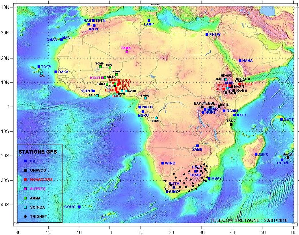
At the present time 35 GPS receivers are operating in 27 countries in Africa. In the near future, with the AGREES network, ten more GPS receivers will be operational the global IHY GPS network will include 45 GPS receivers in 32 different African countries. GPS receivers are low-cost instruments compared to ionosonde and radar. GPS receivers are easy to maintain and provide continuous measurements, hence they are very good candidates for long-lasting research in Africa. Objectives:
Everybody have free access to data from AMMA through the IGS ( ftp://igs.ign.fr/pub/igs/data/). Those who use the GPS data from the AMMA program are invited to acknowledge by citing: Bock, O., M.N. Bouin, E. Doerflinger, P. Collard, F. Masson, R. Meynadier, S. Nahmani, M. Koité, K. Gaptia Lawan Balawan, F. Didé, D. Ouedraogo, S. Pokperlaar, J.-B. Ngamini, J.P. Lafore , S. Janicot, F. Guichard, M. Nuret, (2008) The West African Monsoon observed with ground-based GPS receivers during AMMA, J. Geophys. Res., V.113, D21105, doi:10.1029/2008JD010327. |